Don't forget: You can log in with your Play.net account
File:IcemuleAtlasPlate.jpg: Difference between revisions
Jump to navigation
Jump to search
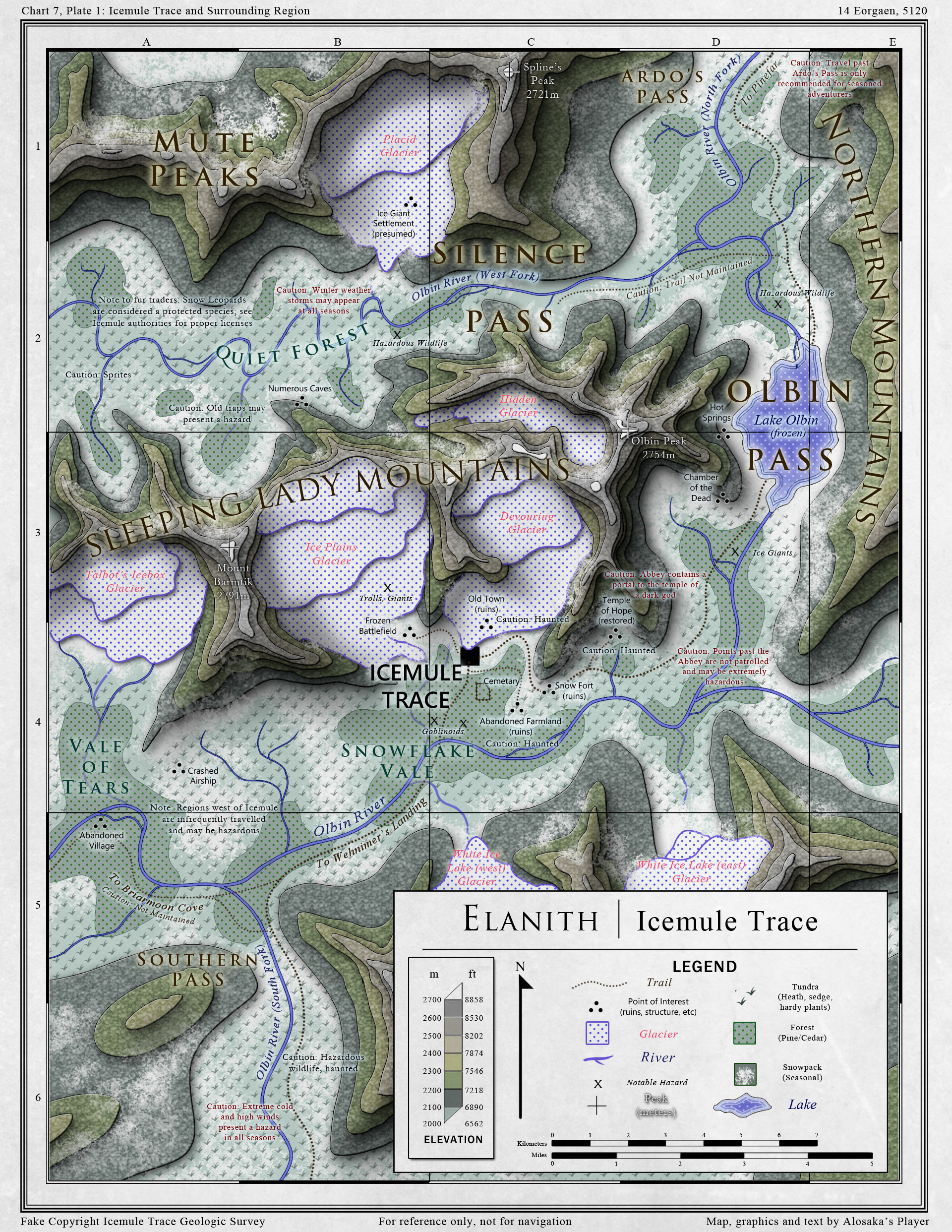
imported>JSEVERNS (Topographic map of Icemule Trace and the surrounding region, prepared for the Icemule Trace Geological Survey by Alosaka.) |
(Maintenance script uploaded File:IcemuleAtlasPlate.jpg) Tag: Server-side upload |
||
(No difference)
| |||


Latest revision as of 03:04, 15 January 2026
Topographic map of Icemule Trace and the surrounding region, prepared for the Icemule Trace Geological Survey by Alosaka.
File history
Click on a date/time to view the file as it appeared at that time.
| Date/Time | Thumbnail | Dimensions | User | Comment | |
|---|---|---|---|---|---|
| current | 03:04, 15 January 2026 | Error creating thumbnail: Unable to save thumbnail to destination | 1,920 × 2,484 (1.97 MB) | Maintenance script (talk | contribs) | == Summary == Importing file |
You cannot overwrite this file.
File usage
The following page uses this file:
